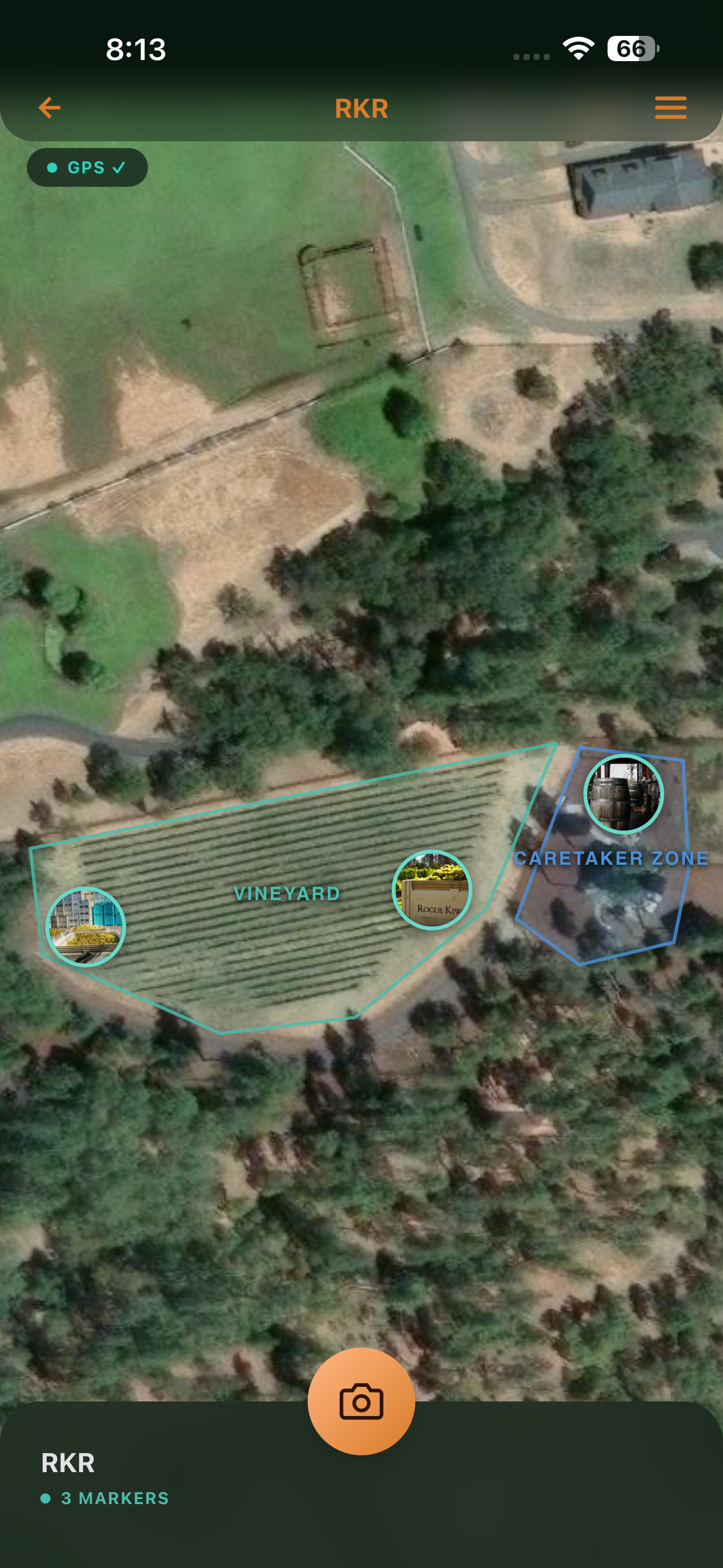
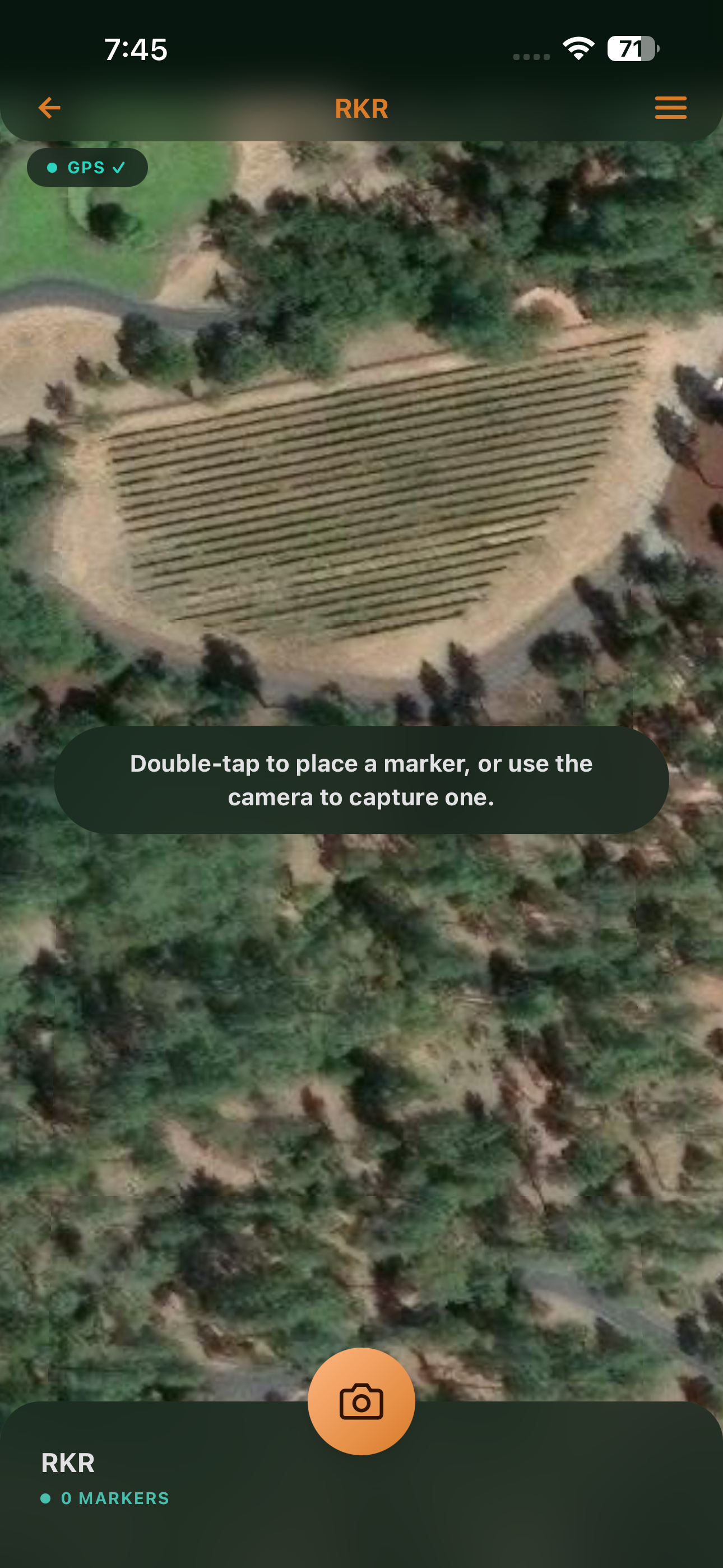
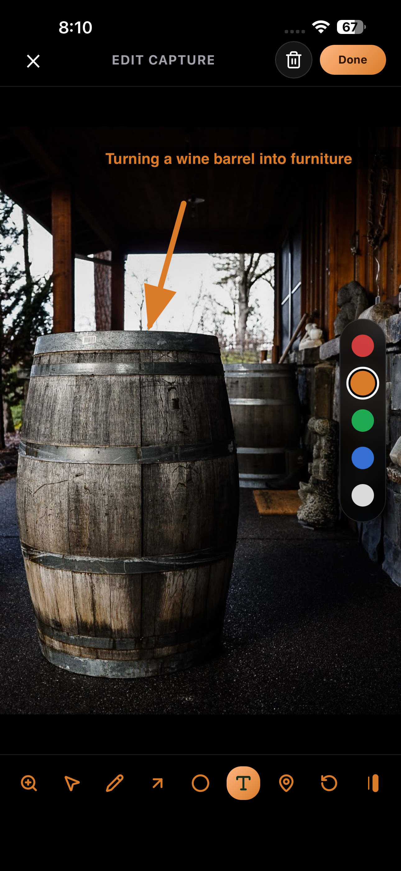
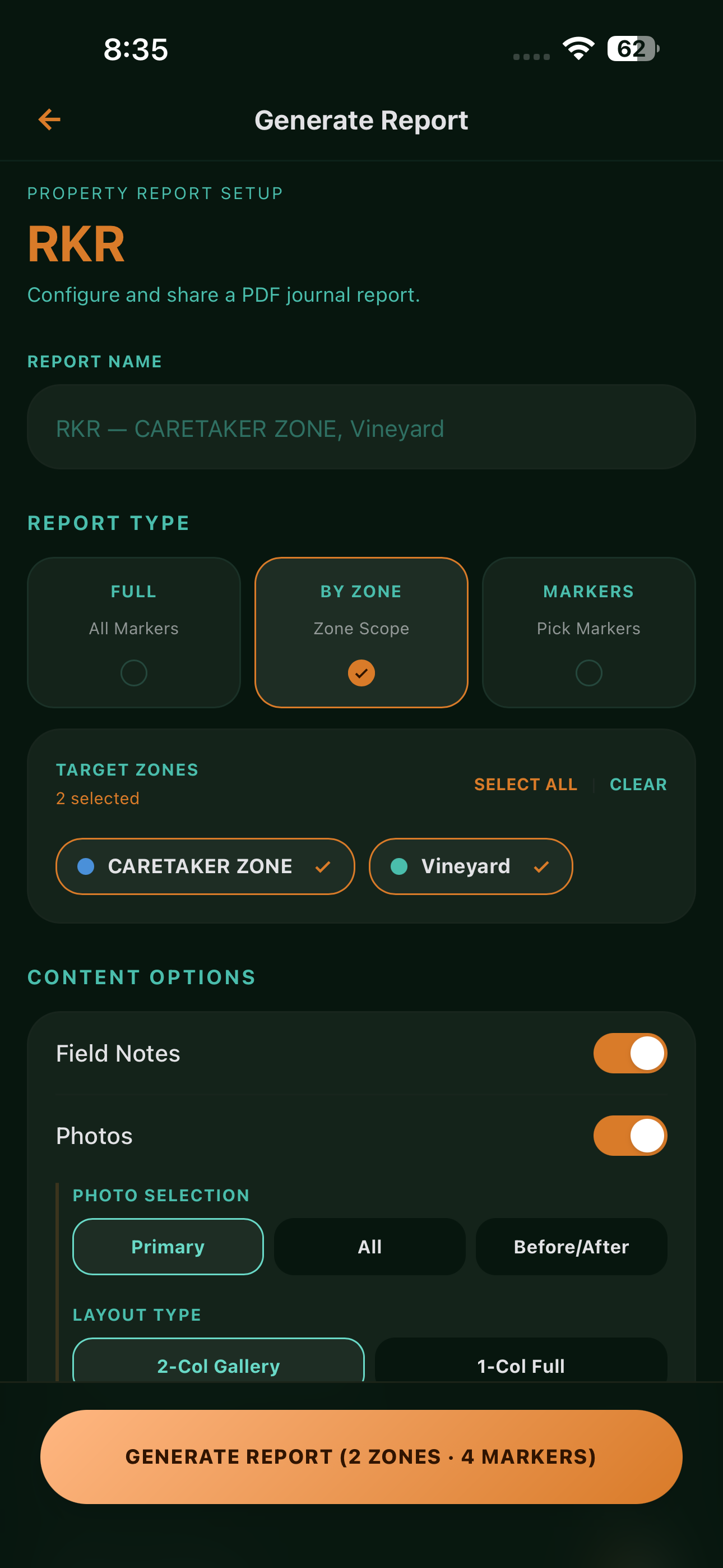
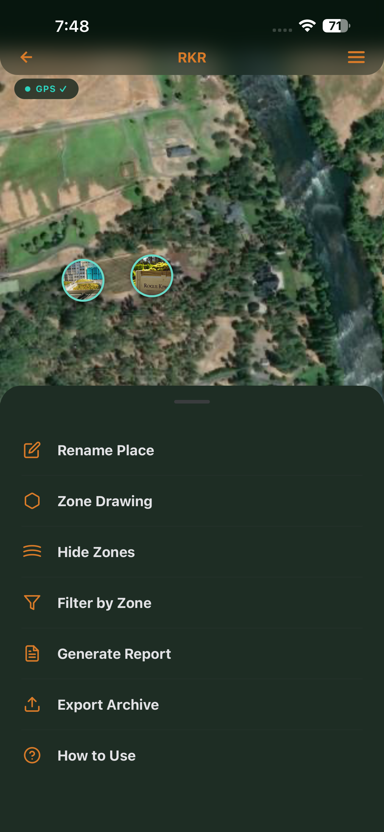
Satellite map. GPS photo markers. Zone drawing. Professional PDF reports. Everything on your iPhone — no subscription, no account, no cloud.
Your camera roll has hundreds of property photos. No idea where half of them were taken or what you were looking at when you shot them.
You spot a fence gap, mental-note it, and it's gone by the time you're back at the desk. Or you email yourself. Or it's in a notebook somewhere.
Getting a clear report to a contractor means digging through photos, writing notes, and formatting a document. A half-day job every time.
PocketHQ gets out of the way and lets you do field work. Everything is where you'd expect it.
Enter an address. PocketHQ geocodes it and drops a draggable pin on a satellite map. Name it. Done.
Tap the camera anywhere on your property. PocketHQ captures the photo and GPS-pins it to your satellite map automatically.
Divide your property into named zones — directly on the satellite map. North Paddock, Orchard, Outbuildings. Markers sort themselves.
Tap Generate Report. Choose Field Summary, Visual Storyboard, or Photo Sheet. PDF ready in seconds.
PocketHQ launches directly to a satellite view of your property. Every documented issue is pinned to its exact GPS location as a photo marker — color-coded by status, filterable by zone or priority.
Tap out a polygon boundary directly on your satellite map. Name it. Color it. Markers inside update their zone automatically when you drag them across the line. Filter or scope reports to a single zone in one tap.
Open any marker photo and draw directly on it — arrow to the problem, circle around the damage, text label for what needs doing. Annotations are saved with the marker and appear automatically in every PDF you generate.
Three formats built for different audiences. Choose what to include, pick the markers or zones that matter, and share straight from the app. No formatting. No desktop required.
Field work happens where signal doesn't reach. PocketHQ keeps everything on device — satellite tiles cached when you set up a place, GPS active in airplane mode, all data in private on-device storage. Nothing requires a server. Nothing ever leaves your phone.
One time. Not one year.
We made one pricing decision and we're sticking to it. PocketHQ costs $9.99. That's the whole price. Everything in the app is yours when you buy it.
If you own or manage a physical property with issues to track and people to report to, PocketHQ is for you.
Track fence lines, irrigation, pest activity, and infrastructure across large parcels. Generate reports for your manager or insurer.
Document issues across grounds, outbuildings, and facilities. Share professional reports with property owners and contractors.
Map and document snag lists, safety issues, and progress on any site. Photo evidence with GPS pinned to exactly where it was taken.
Conduct property surveys with a structured, map-first workflow. Professional PDF output ready the moment inspection wraps.
Maintain a living record of every issue across your building or campus. Track status from reported to resolved.
No app experience needed. PocketHQ is designed for people who work outdoors, not people who work in offices.